About Kayak Spot Finder
The most comprehensive kayak waterway and service directory in America.
Our Mission
Finding great kayak spots shouldn't be hard. But right now, information about launch points, water conditions, and kayak-friendly locations is scattered across dozens of websites, local forums, and word-of-mouth recommendations.
Kayak Spot Finder brings it all together in one searchable directory. Whether you're looking for a calm lake for a family outing, a river with Class II rapids, or a coastal bay with great fishing — we help you find the perfect paddle.

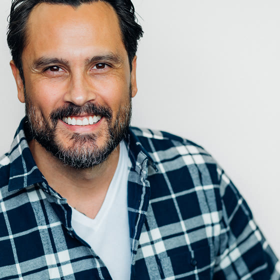
Who runs this
My name is Tyson Gancayco-Adlao. I built Kayak Spot Finder and I answer its email myself — no team, no support queue.
I want to be straight with you about what this site is, because plenty of directories are not. I have not paddled most of the launches listed here. Nobody has paddled five thousand launches. So rather than dress up guesses as local knowledge, every fact on a launch page is taken from a named source and labelled with where it came from, and anything I do not have, I leave blank instead of filling in.
That means you will sometimes see an empty field. That is deliberate. A blank is honest; an invented parking count is not, and you are the one who would drive there and find out.
Where the information comes from
- State agency launch records
- Where a state publishes its boating-access inventory, that record is shown directly on the launch page — ramp type, parking counts, permit requirements, hours — and cited with the date the agency last edited it. Michigan is live; more states are being added.
- USGS GNIS and OpenStreetMap
- The names, locations and water types of the waterways themselves come from the federal geographic names database and OpenStreetMap.
- Google Places
- Ratings, review counts and photographs, where a launch has them. Ratings are never written by us.
- Operators and readers
- Corrections sent by the people who run these businesses, or who paddle these waters, are applied by hand.
Found something wrong? Tell me and I will fix it.
This is not a form letter. Corrections that arrive by email get made, usually the same day. A paddleboard rental that was listed as kayak-only was repaired from the operator's own site the day it was noticed. A listing that named the wrong lake in the wrong state was pulled apart and rebuilt. When someone asks about a launch and I cannot help, I say so and point them somewhere that can, rather than sending them a rate I am not sure of.
info@kayakspotfinder.comBy the Numbers
5,134+
Waterways Mapped
562+
Kayak Services
50
States Covered
11
Expert Guides

What We Track
Water Type & Conditions
Lakes, rivers, bays, reservoirs, creeks — with difficulty ratings and seasonal info.
Fishing & Crabbing
Which waterways allow fishing or crabbing, target species, and license requirements.
Launch Access
Boat ramps, kayak launches, parking availability, and public access status.
Nearby Services
Rental shops, guided tours, and fishing charters within 25 miles of every waterway.
Why It Matters
Kayaking is one of the fastest-growing outdoor activities in America, with over 18 million participants annually. But finding safe, accessible waterways with current conditions and nearby services has always required local knowledge.
We're building the directory that makes that knowledge accessible to everyone — whether you're a first-timer looking for a calm lake or an experienced angler targeting dungeness crab from a kayak in Tomales Bay.

Ready to Paddle?
Browse our directory or share your favorite spots with the community.